Description:
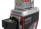
The HydroRANGER is an evolution of mapping technology. This airborne topo-bathymetric (ATB) system provides dual purpose topographic and bathymetric measurements for full scene mapping of shoreline systems. Utilizing a visible green spectrum laser with an elliptical scan pattern and measurements rates up to 200 kHz, the HydroRANGER provides a combination of high spatial resolution and spatial accuracy. Reaching potentially beyond 2 Secchi depths, this is the ideal solution for mapping landwater interface environments, rivers, and reservoirs.
Features:
- Green light laser (532 nm) with online waveform processing for topographic, water surface and subsurface target mapping
- Elliptical scan pattern provides a +/- 20 degree horizontal FOV for low angle of incident measurements
- High quality 24 MP camera enables RGB colorization and orthophotography
- Configurable beam divergence and receiver FOV for low AGL missions
Specifications:
- Water Depth Penetration: 2.0 Secchi Depths @ 50 kHz
- PP Attitude Heading RMS Error: 0.01° IMU options
- Weight: 13 kg / 28.7 lbs approx.
- Dimensions: 432 x 337 x 202 mm (L x W x H)
- Scan Rate: 200,000 shots/second, up to 15 returns


