Description:
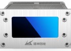
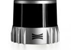
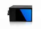
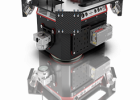
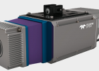
The RANGER-ULTRA is an airborne laser scanner with an impressive combination of weight, range, accuracy and pulse rate. It is equipped with a unique forward and rear looking FOV designed to minimize laser shadowing and provide geometry on complex vertical structures on a single pass. With its wide field of view of 100 degrees and an extremely fast pulse repetition rate of up to 1.8 MHz, the RANGER-ULTRA is perfectly suited for high point density corridor mapping applications such as power line, railway track and pipeline inspection.
Features:
- Modular and upgradable for maximum project flexibility, supporting single/dual RGB, and multispectral cameras
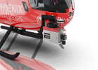
- Easily mountable to unmanned platforms (UAVs) and to helicopters, gyrocopters, and other small manned aircrafts
- Operating flight altitude up to 720 m / 2,350 ft
- Scan speed up to 400 lines/second
- 3 faceted mirror (-10, 0, +10°) creates a virtual multilaser for improved mapping of vertical surfaces
Specifications:
- Absolute Accuracy: 25-50 mm @ 350 m range
- PP Attitude Heading RMS Error: 0.010° / 0.019° IMU options
- Weight (including AIR NavBox): 3 kg / 6.5 lbs
- Dimensions (approx, with AIR NavBox and Quickrelease): 242 x 117 x 215 mm
- Laser Range: 760 m @ 20% reflectivity
- Scan Rate: 1800 kHz, up to 15 returns
PLATFORM
- OVERALL DIMENSIONS (with AIR NavBox): 242 x 117 x 215 mm
- OPERATING VOLTAGE: 12-28 V DC
- POWER CONSUMPTION: 60W typical
- OPERATING TEMPERATURE: 0° - 40° C
- WEIGHT (including Air NavBox): 3 kg / 6.5 lbs approx
LIDAR SENSOR
- LASER PROPERTIES: 1550 nm
- RANGE MIN: 5 m
- MAX EFFECTIVE MEASUREMENT RATE: up to 1,500,000 meas./sec
- HORIZONTAL FIELD OF VIEW: 100°
- ACCURACY: 10 mm
- PRECISION: 5 mm
- LASER BEAM DIVERGENCE: 0.4 mrad
- LASER BEAM FOOTPRINT (GAUSSIAN BEAM DEFINITION): 40 mm @ 100 m, 200 mm @ 500 m, 400 mm @ 1000 m
- MAX MEASURING RANGE ρ 20% (ρ 60%): 760 m (1260 m)
- PROTECTION CLASS: IP64 dust and splash-proof
- WEIGHT: 2.0 kg approx
- POWER CONSUMPTION: 45W typical


