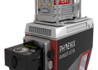
Manufacturer: Phoenix LiDAR Systems
Description:
The HALO series LiDAR scanners are made for high altitude high efficiency mapping. City scale lidar projects are easily achievable with swath widths reaching 4,000 m. Selectable measurement rates up to 1 MHz and line speed up to 250 per second can be tuned to meet challenging pulse density specification. The HALO-10 is available in two different models; the HALO-10CM and HALO-10LR. The CM variant is designed for city and corridor mapping applications. The LR variant is a general-purpose longer range mapping system and can accommodate greater terrain relief due to its higher maximum flying heights.
Features:
- High density 1 MHz mapping
- Narrow 0.3 mrad beam divergence results in excellent accuracy & precision
- 1030 nm laser wavelength for better measurement probability through various environmental conditions
- An 80° field of view for quick coverage of wide areas
Specifications:
Absolute Accuracy (1)(2)(3) : TBD
Intraswath Precision (1)(2)(4) : 6 cmRMSDz @ 750 m (preliminary)
EXAMPLE ACQUISITIONS:
Helicopter (HALO-10CM)
- 400 m AGL, 60 knots, 80° FOV, 1000 kHz
- Swath Width = 670 m
- Avg. Density = 42 points/m2
- Collection Rate = ~75 km2/hr
Fixed Wing (HALO-10LR)
- 1100 m AGL, 100 knots, 80° FOV, 500 kHz
- Swath Width = 1845 m
- Avg. Density = 4 points/m2
- Collection Rate = ~345 km2/hr
- OVERALL DIMENSIONS*: 51.9 x 21.6 x 24.8 cm
- OPERATING VOLTAGE: 12-28 V DC
- POWER CONSUMPTION*: Max. 155W
- OPERATING TEMPERATURE: 0° - 40° C / 32° - 104° F
- WEIGHT*: ~30 kg / 66 lbs