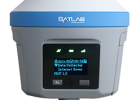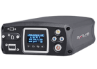




Spectra Geospatial® SP85
Manufacturer: Spectra Geospatial
Description:
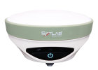
The Spectra Geospatial® SP85 is a next generation GNSS receiver that combines decades of GNSS RTK technology with revolutionary new GNSS processing. Featuring the new 600-channel “7G” chipset combined with the patented Z-Blade™ technology, the SP85 system is optimized for tracking and processing signals from all GNSS constellations in challenging environments. With unmatched connectivity in the GNSS receiver market, the SP85 offers a unique combination of integrated 3.5G cellular, WiFi and UHF communications with SMS, email and anti-theft technology. These powerful capabilities, packaged in an ultra-rugged housing and patented antenna design, make SP85 an extremely versatile turnkey solution that can be used with unlimited operation time because of the SP85’s hot-swappable, dual battery setup.
Features:
- Patented Z-Blade™ technology
- 600-channel 7G ASIC
- Hot-swappable batteries
- Internal TxRx UHF radio
- L-band satellite capable GNSS antenna
- 3.5G cellular modem
- Built-in WiFi communication
- SMS and e-mail alerts
- Anti-theft technology
- Backup RTK
- RTK bridge
- eLevel technology
- Up to 20 Hz update rate
GNSS CHARACTERISTICS
-
600 GNSS channels
- GPS L1C/A, L1P(Y), L2C, L2P(Y), L5
- GLONASS L1C/A, L1P, L2C/A, L2P, L3
- BeiDou (Phase III) B1, B2
- Galileo E1, E5a, E5b, E5 AltBOC
- QZSS L1C/A, L1C, L2C, L5
- IRNSSL5
- SBAS L1C/A, L5(WAAS, EGNOS, MSAS, GAGAN, SDCM)
- L- band MSS -
Patented Z-Blade technology for optimal GNSS performance
- Full utilization of signals from all 7 GNSS systems (GPS, GLONASS, BeiDou, Galileo, QZSS, IRNSS and SBAS)
- Enhanced GNSS-centric algorithm: fully-independent GNSS signal tracking and optimal data Processing, including GPS-only, GLONASS-only, Galileo-only, or BeiDou only solution (Autonomous to full RTK) - Fast Search engine for quick acquisition and re-acquisition of GNSS signals
- SBAS rang ing for using SBAS code & carrier observations and orbits in RTK processing
- Patented Strobe™ Correlator for reduced GNSS multi-path
- Up to 20 Hz real-time raw data (code & carrier and position output)
- Supported data formats: ATOM, CMR, CMR+, RTCM 2.1, 2.2, 2.3, 3.0, 3.1 and 3.2 (including MSM), CMRx and sCMRx (rover only)
- NMEA 0183 messages output
REAL-TIME ACCURACY (RMS) (1)(2)(7)
SBAS (WAAS/EGNOS/MSAS/GAGAN)
- Horizontal: < 50 cm
- Vertical: < 85 cm
Real-Time DGPS position
- Horizontal: 25 cm + 1 ppm
- Vertical: 50 cm + 1 ppm
Real-Time Kinematic Position (RTK)
- Horizontal: 8 mm + 1 ppm
- Vertical: 15 mm + 1 ppm
Network RTK (6)
- Horizontal: 8 mm + 0.5 ppm
- Vertical: 15 mm + 0.5 ppm
POST-PROCESSED KINEMATIC (PPK)
- Horizontal: 8 mm + 1 ppm
- Vertical: 15 mm + 1 ppm
REAL-TIME PERFORMANCE
-
Instant-RTK® Initialization
- Typically 2 sec for baselines < 20 km
- Up to 99.9% reliability - RTK initialization range: over 40 km
POST-PROCESSING ACCURACY (RMS) (1)(2)(7)
Static & Fast Static
- Horizontal: 3 mm + 0.5 ppm
- Vertical: 5 mm + 0.5 ppm
High-Precision Static (3)
- Horizontal: 3 mm + 0.1 ppm
- Vertical: 3.5 mm + 0.4 ppm
DATA LOGGING CHARACTERISTICS
Recording Interval
- 0.05 - 999 seconds
PHYSICAL CHARACTERISTICS
Size
- 22.2 x 19.4 x 7.5 cm (8.7 x 7.6 x 3.0 in)
Weight
- 1.17 kg (2.57 lb)
User Interface
- Graphical PMOLED display
- WEB UI (accessible via WiFi) for easy configuration, operation, status, and data transfer
I/O Interface
- RS232 serial link
- USB 2.0/UART
- Bluetooth 5.0 dual mode
- WiFi (802.11 b/g/n)
- 3.5G quad-band GSM (850/900/1800/1900 MHz) / penta-band UMTS module (800/850/900/1900/2100 MHz)
Memory
- 4GB internal memory NAND Flash (3.5 GB user data)
- Over two years of 15 sec. raw GNSS data from 14 satellites
- SD/SDHC internal memory card (up to 32GB)
Operation
- RTK rover & base
- RTK network rover: VRS, FKP, MAC
- NTRIP, Direct IP
- CSD mode
- Post-processing
- RTK bridge
- UHF repeater
- UHF networking
Environmental Characteristics
- Operating temperature: -40° to +65°C (-40° to +149°F) (4)
- Storage temperature: -40° to +85°C (-40° to +185°F) (5)
- Humidity: 100% condensing
- IP67 waterproof, sealed against sand and dust
- Drop: 2m pole drop on concrete
- Shock: ETS300 019
- Vibration: MIL-STD-810F
Power Characteristics
- 2 Li-Ion hot-swappable batteries, 41.4 Wh (2 x 7.4 V, 2800 mAh)
- Battery life time(two batteries): 10 hrs (GNSS Cn, and GSM or UHF Rx Cn)
- External DC power: 9-28 V
Standard System Components
- SP85 receiver
- 2 Li-Ion batteries
- Dual battery charger, power supply and international power cord kit
- Tape measure (3.6 m / 12 ft)
- 7 cm pole extension
- USB to mini-USB cable
- Hard case
- 2 year warranty
Optional System Components
- SP85 UHF Kit (410-470 MHz 2W TRx)
- SP85 Field Power Kit
- SP85 Cffice Power Kit
-
Data collectors
- ST10
- Ranger™ 7
- Ranger™ 3
- T41
- MobileMapper® 60
- MobileMapper® 50 -
Field software
- Survey Pro
- Survey Mobile (Android)
- SPace control app for 3rd party devices (Android)
1 Accuracy and TTFF specifications may be affected by atmospheric conditions, signal multipath, satellite geometry and corrections availability and quality.
2 Performance values assume minimum of five satellites, following the procedures recommended in the product manual. High multi-path areas, high PDOP values and periods of severe atmospheric conditions may degrade performance.
3 Long baselines, long occupations, precise ephemeris used
4 At very low temperatures UHF module should not be used in the transmitter mode.
5 Without batteries. Batteries can be stored up to +70°C.
6 Network RTK PPM values are referenced to the closest physical base station.
7 Receiver initialization time varies based on GNSS constellation health, level of multipath, and proximity to obstructions such as large trees and buildings.