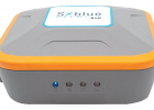
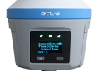
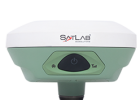
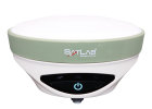
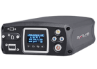
Manufacturer: SATLAB GEOSOLUTIONS
Description: Powered by multi-constellation tracking, SL700 offers accurate and precise results with improved performance. Armed with an advanced engine, this GNSS receiver features a multi-device interface depending on your application which boosts your productivity and efficiency.
The SL700 has TerraStar capabilities that use a global network of multi-GNSS reference stations and advanced algorithms to generate highly precise GNSS satellite orbit, clock, biases, and other system parameters. These data allow TerraStar to provide correction services with sub-metre or centimetre-level positioning accuracy to SL700 receivers. Get your corrections transmitted in real-time, with minimal latency via satellites and cellular networks worldwide.
Data Specifications:
GNSS PARAMETERS
No. of Channels: 800+
Signal Tracking:
- GPS (LI, L2, L5,L2C)
- GLONASS (L1, L2, L3)
- BeiDou (B1, B2, B3, B1C, B2a)
- Galileo (E1, E5, AltBOC, E5a, E5b, E6)
- QZSS (L1, L2, L5, L6) SBAS (L1, L5)
- IRNSS(L5)
MEASUREMENT PERFORMANCE
- Real-time Kinematic: H: 8mm + 1ppm RMS / V: 15mm + 1ppm RMS
- Network RTK: H: 8mm + 0.5ppm RMS / V: 15mm + 0.5ppm RMS
- High-precision Static: H: 2.5mm + 0.1ppm RMS / V: 3.5mm + 0.4ppm RMS
- Static and Fast Static H: 2.5mm + 0.5ppm RMS / V: 5mm + 0.5ppm RMS
- DGPS H: 0.25m + 1ppm RMS / V: 0.5m + 1ppm RMS
- Initialization time: <10s
- Initialization Reliability: 99.9%
-
Hi- Fix4:
H: RTK5+10mm/minute RMS/
V: RTK5+ 20mm RMS
COMMUNICATIONS
Network:
- Internal 4G mobile network, including TDD-LTE/FDD-LTE/ WCDMA/EDGE/GPRS/GSM modes.
- V4.0/2.1+EDR
- 2.4GHz , 802.11b/g/n
Bluetooth: Yes
Wifi: Yes
NFC: USB
I/O Interface: TNC antenna port, SIM card slot, DC power input (5-pin)
INTERNAL RADIO
- Frequency: 403MHz~473MHz
- Power: 1W/2W/4W adjustable
- Protocols: HI-TARGET, TRIMTALK450S, TRIMMARK III, TRANSEOT, SATEL-3AS, etc..
- Transmitting Speed: 19200 bps/9600 bps
- Working Range: Typically 5km, optimally 8-10km
INTERNAL RADIO (OPTIONAL)
- Frequency: 865MHz~867MHz
- Power: 10, 20, 50, 100, 200, 500, 1000 mW adjustable
- Protocols: SATEL 3AS
- Transmitting Speed: 9600 - 115200 bps
- Working Range: Distances ranging from tens or hundreds of metres up to around 80 kilometres.
DATA MANAGEMENT
- Positioning Output Frequency: 1Hz~20Hz
- TerraStar and RTK Assist service: /
- Output Format: ASCII: NMEA-0183, binary data
- Message Type: CMR, RTCM2.X, RTCM3.0, RTCM3.2
- Static Data Format: GNS, Rinex
SYSTEM
- Operation System: Linux
- Data Storage: 8GB internal storage
ENVIRONMENT
Water/dustproof:
- IP67 environmental protection
- Waterproof to 1m (3.28ft) depth
- Temporary Submersion
Free Fall: Shock resistant body to 2m (6.5ft) pole drop
Operation Temperature: -40C 〜65C
Storage Temperature: -40 C 〜85 C
Humidity: 95%, condensing
PHYSICAL PROPERTIES
- Internal Battery: 5000mAh lithium-ion rechargeable and remove battery
- Internal Battery Life: RTK rover (UHF/Cellular) >13 hours
- External Power: 6〜28V DC
- Power Consumption: 4.2W
- Weight: <1.2kg (without battery)